Our Waterways

Blue Water Bridge in Port Huron
connecting US & Canada |
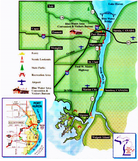
St. Clair County has over 110 shoreline miles of navigable waterways within the
jurisdictional boundaries of the United States. This includes the lower portion
of Lake Huron, the St. Clair River with its North, Middle and South Channels and
their connecting tributaries (known as the St. Clair River delta/flats region),
the eastern portion of Lake St. Clair and the Black, Pine and Belle Rivers. This
region of Michigan is known as the busiest marine thoroughfare for pleasurecraft
in the world. Michigan has nearly 1 million registered watercraft - more than any
other state. Most of these boats are found in southeastern Michigan, which includes
St. Clair County. The St. Clair River with its South Channel handles a very high
volume of commercial shipping traffic. Any pleasurecraft or commercial freighter
traversing between the lower and upper Great Lakes must pass through St. Clair County.
Vessels of all sizes from neighboring states, Canada and foreign countries can be
found navigating St. Clair County waterways. The Marine Patrol provides services
to this area in addition to assisting the marine patrols of adjoining Macomb and
Sanilac Counties, the United States Coast Guard and other law enforcement and rescue
agencies of the United States and our neighbors in Canada.

St. Clair County, Michigan, USA